Click here for the full Environment & Mobility Section
SEE FULL TEXT BELOW:
ENVIRONMENT & MOBILITY
Detroiters need to be able to conveniently and reliably get to work, school, church, stores, and parks.
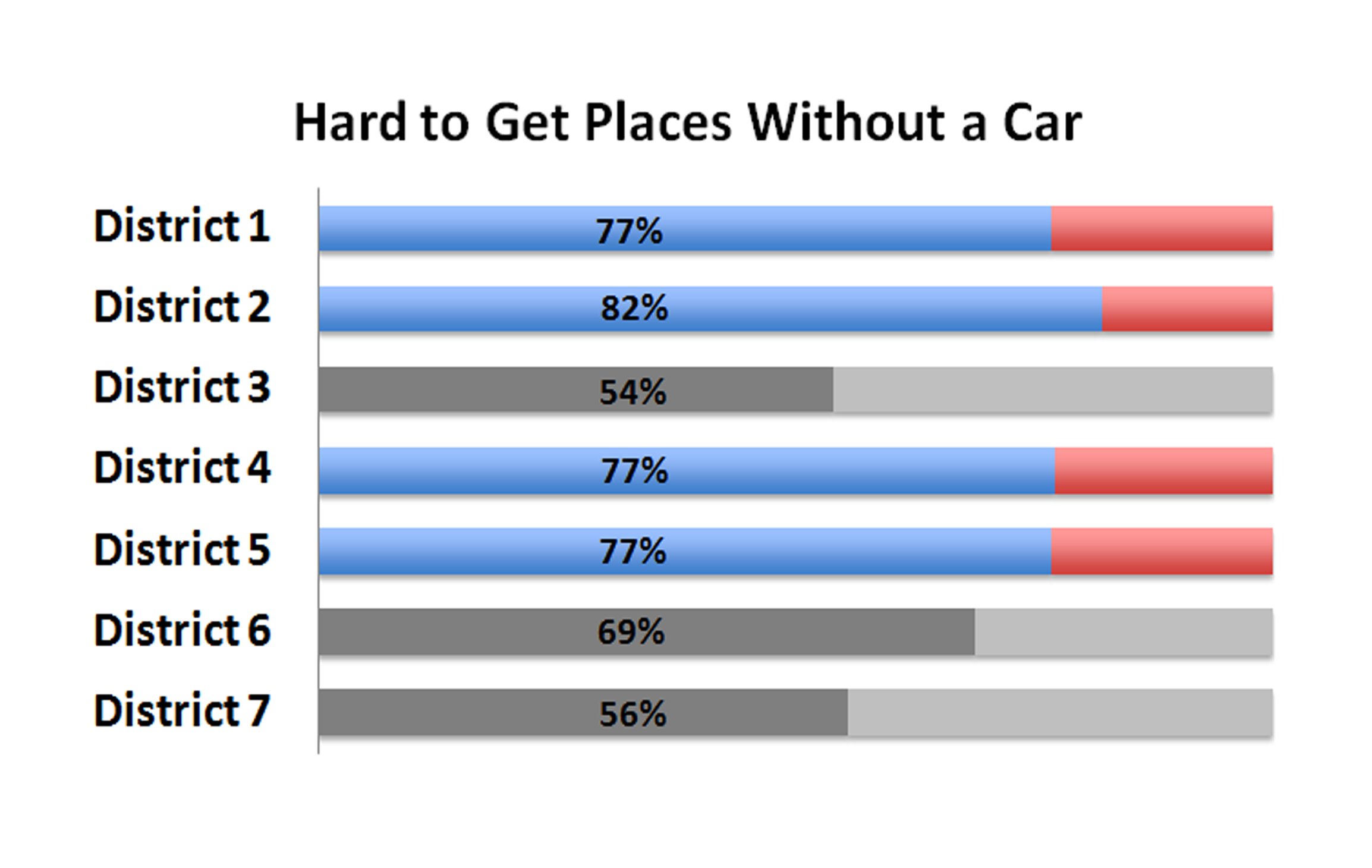
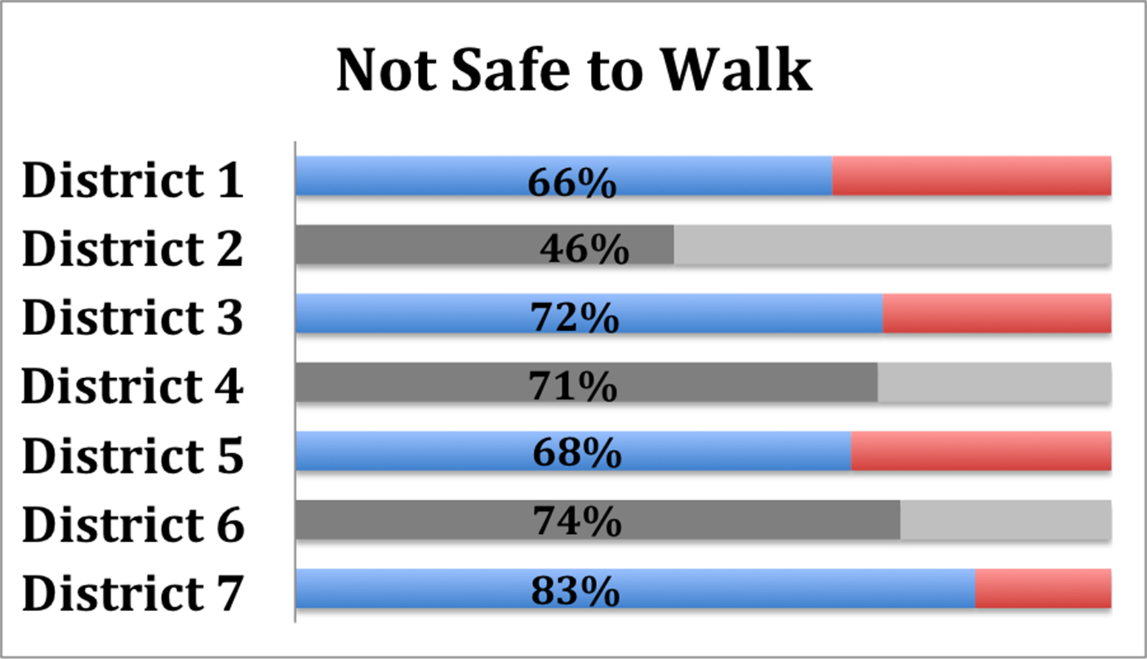
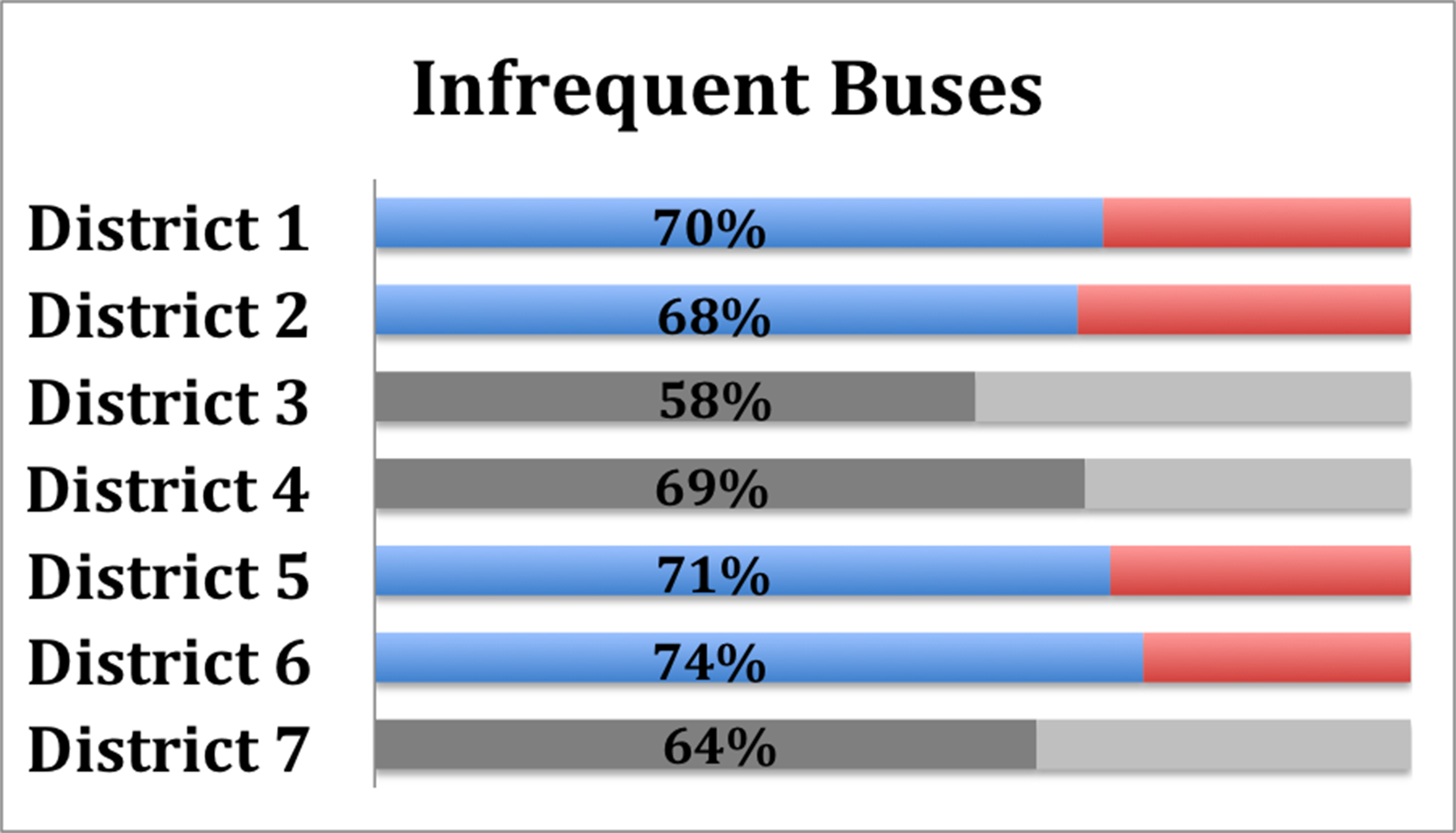
Several surveyed challenges related to lack of mobility ranked in the top 10 problems in at least 4 out of 7 districts. As indicated by the DEA survey results and numerous other forms of civic engagement, mobility and transportation are priority issues in Detroit.
Therefore, we need to ensure reliable public transportation, “complete streets” safe for all users including pedestrians and cyclists, and mixed use neighborhoods with amenities.
As retail, grocery stores, factories, and jobs have moved out of the city, residents are left with long, unreliable bus commutes or limited choices within the city.
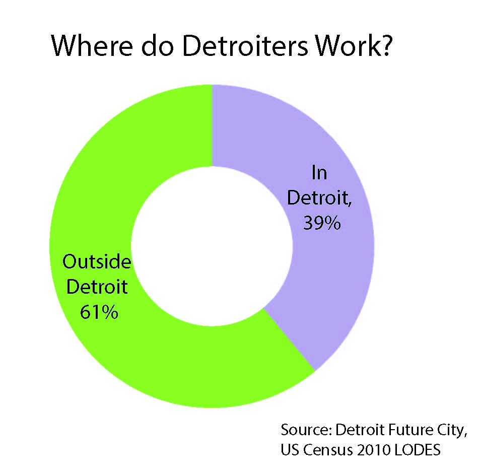
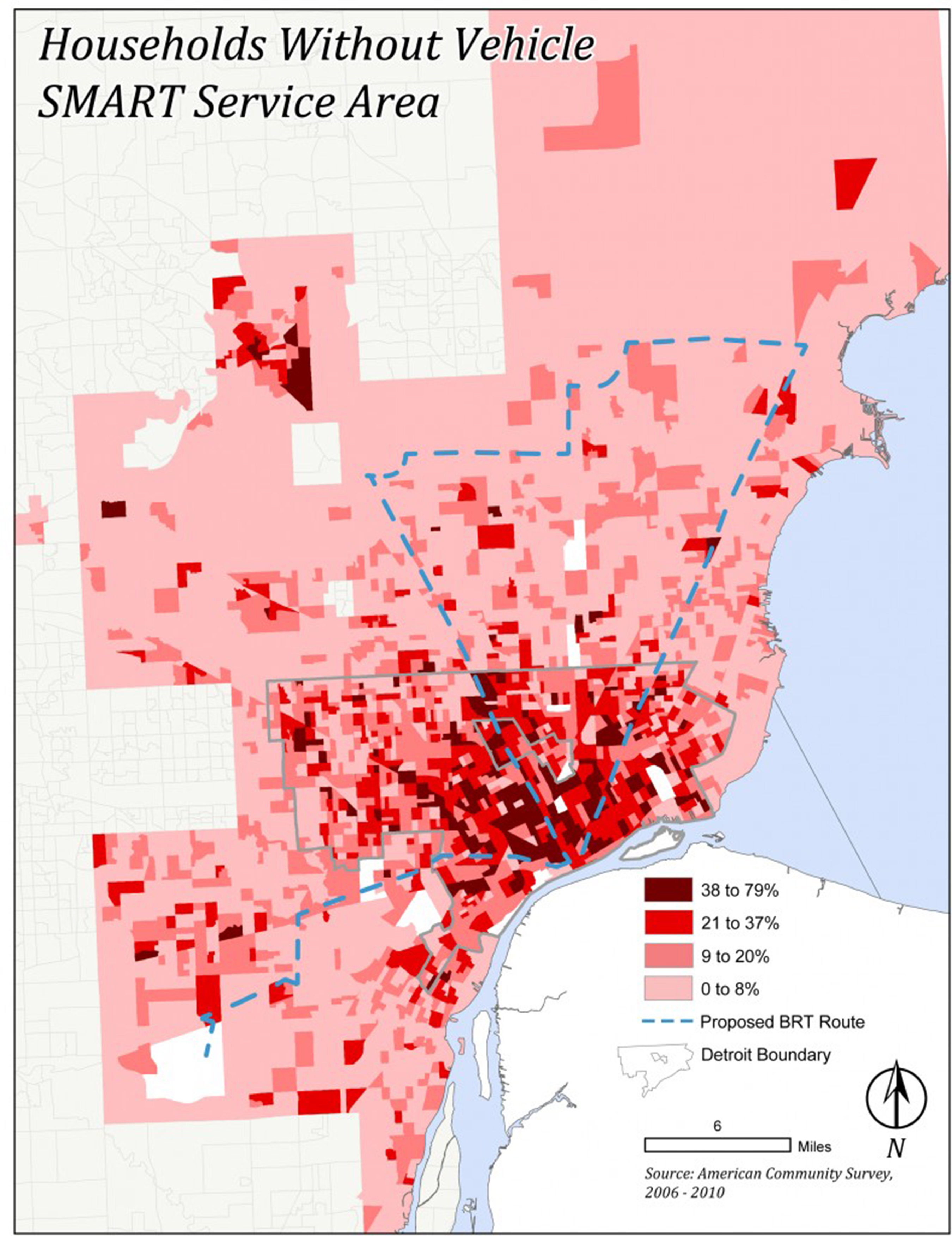
According to the U.S. Census Longitudinal Employer-Household Dynamics, 70% of all jobs located in Detroit are occupied by people who don’t live in or pay taxes to the city. Of the residents who are employed, 60% of them travel outside of the city to their jobs. In addition, as of May 2012, 20.46% of Detroit Public School students rely on DDOT buses to get to school (MISchoolData.org, Data Driven Detroit July 2013). 1 in 4 Detroit households do not have access to a vehicle (American Community Survey 2011), leaving over 100,000 Detroiters dependent on rides, public transportation, walking, biking, or other means of travel.
There are significant challenges to car ownership in Detroit – high insurance rates, cost of owning a car, cost of fuel. Also, Detroiters suffer from high rates of asthma and other illnesses that are exacerbated by motor vehicle emissions.
However, according to the 2011 American Community Survey, Detroiters who rely on public transportation are more than 5 times as likely to have to commute for an hour or more than those who drive, bike, or walk. After comparing published schedules to actual arrival times of buses along right major routes during the week of October 17-21, 2012, Transit Rider United gave the DDOT bus system a D for on-time performance, up from a D- grade given that spring.
It’s been a busy couple couple of years for metro Detroit transportation.
REGIONAL TRANSIT AUTHORITY
After 23 failed attempts since the 1970s, a Regional Transit Authority was finally established by the Michigan Legislature and signed by the Governor in 2012 to coordinate, oversee, and improve transit for Macomb, Oakland, Washtenaw, and Wayne Counties, including Detroit. The RTA board is tasked with developing a regional master transit plan for the four represented counties including Detroit, coordinating existing transit providers, and raising federal and state funding to implement the plan. A key component of preliminary plans is to establish a bus rapid transit service from Detroit to Pontiac along Woodward Avenue.
BUS RAPID TRANSIT
After months of study, Bus Rapid Transit (BRT) emerged as the leading option for the 27-mile corridor along Woodward Avenue from Detroit to Pontiac. According to Carmine Palombo, director of transportation planning for the Southeast Michigan Council of Governments, the project aims to “provide high level, fast transit service that would compete with the automobile from Pontiac to Detroit’s riverfront and vice versa.” (Crain’s Detroit Business April 2013) Michigan will spend a $25 million federal TIGER grant on this first phase. A 110-mile regional BRT system is believed to be cheaper to build than the canceled $528 million 9.3-mile light rail system would have cost.
M1 RAIL
The light rail along Woodward Avenue is finally funded to begin construction this summer downtown, south of Adams Street. The $137-40 million private-public project will extend 3.3 miles up Woodward Avenue (also known as M1) from Detroit’s Hart Plaza to New Center, and cost an estimated $5.1 million per year to operate. M1 will run an 11-stop, mostly curbside, fixed-rail streetcar circulator system, commingled with traffic. At its north and south ends, the streetcars will run in the median. There is a future 12th stop proposed.
TEXTMYBUS
As part of efforts to improve rider experience on local buses, the Detroit Department of Transportation partnered with Code for America Fellows to develop a mobile text service called TextMyBus and smartphone app called Stop313 that uses GPS systems on the buses to tell bus riders exactly when the next three buses for a requested stop will arrive.
I-94 EXPANSION APPROVED
Despite strong public opposition, SEMCOG approved the $1.8 billion 7-mile expansion of I-94 from 6 lanes to 10, from I-96 through Midtown eastward to Conner Avenue.
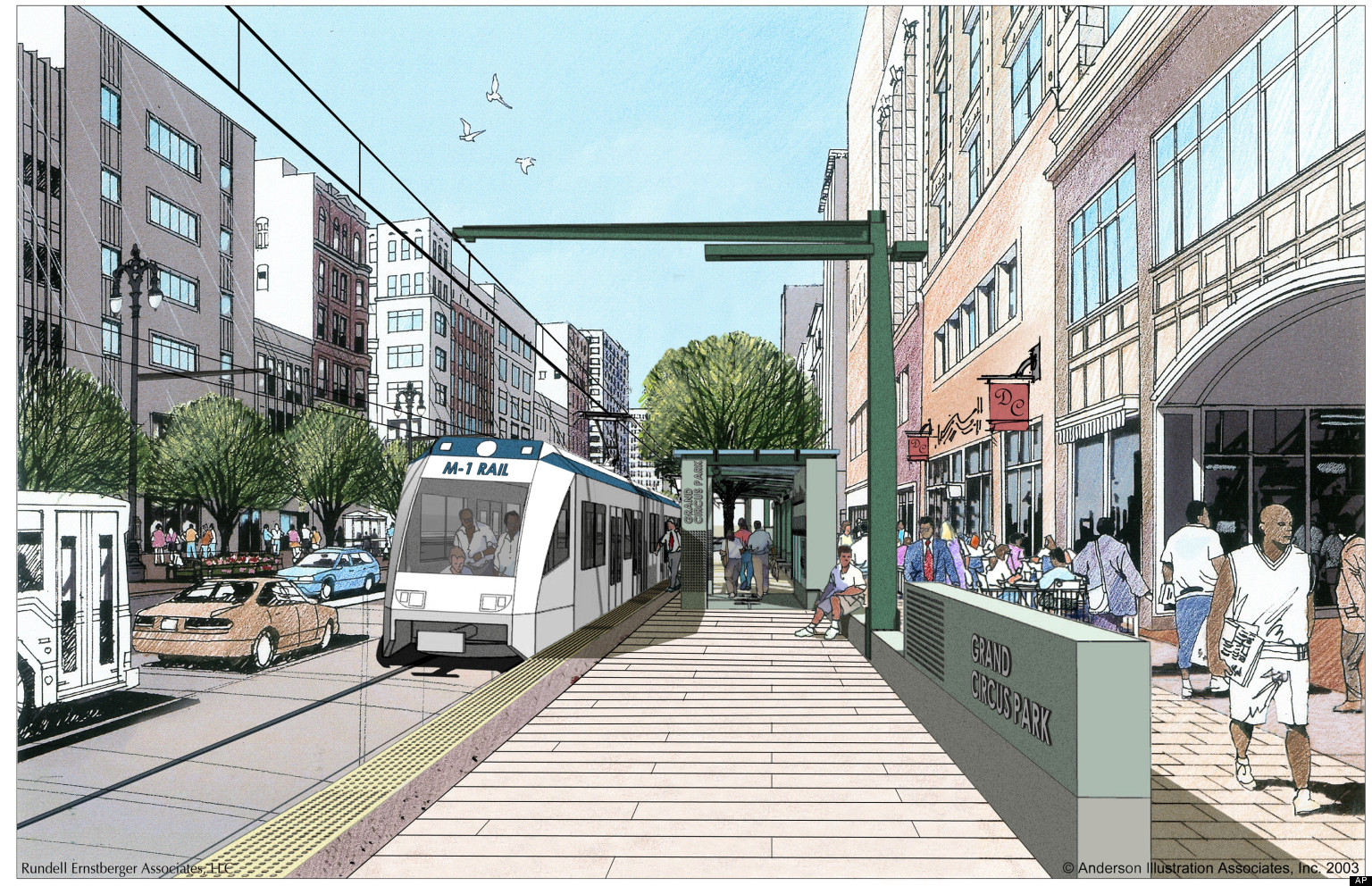
Source: M1 Artist renderings
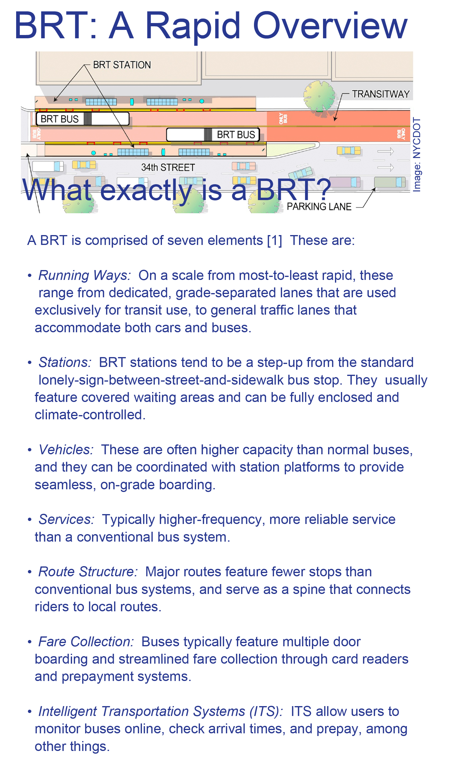
Source: NYCDOT
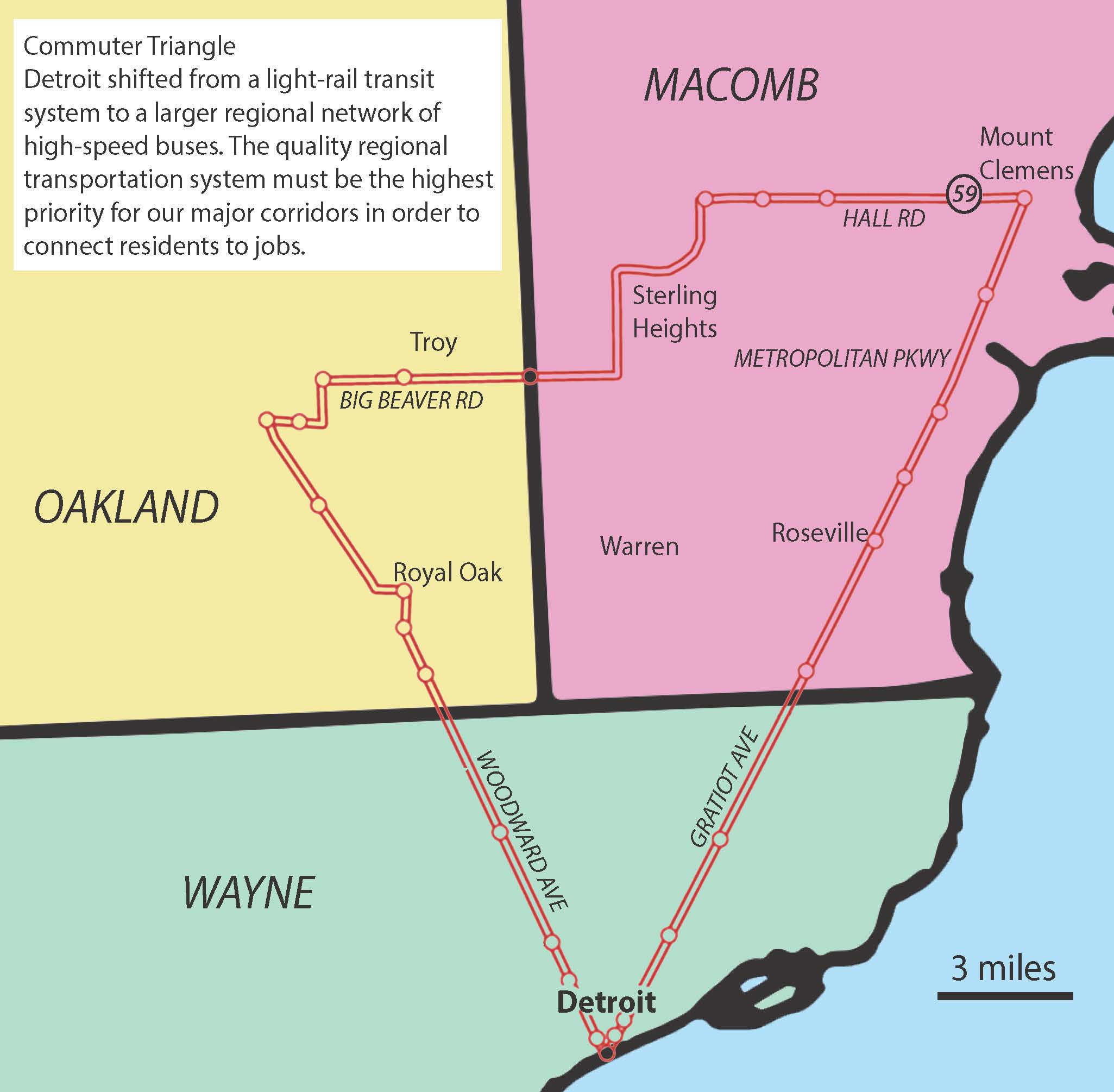
Commuter Triangle: Detroit shifted from a light-rail transit system to a larger regional network of high-speed buses. The quality regional transportation system must be the highest priority for our major corridors in order to connect residents to jobs.
TextMyBus uses DDOT’s real-time bus tracking to tell bus riders when the next bus will arrive.
1. Text your nearest intersection to 50464
2. You will receive a list of nearby bus routes
3. Text back your desired route
4. You will get a message back indicating the closest bus stop and next three bus arrival times
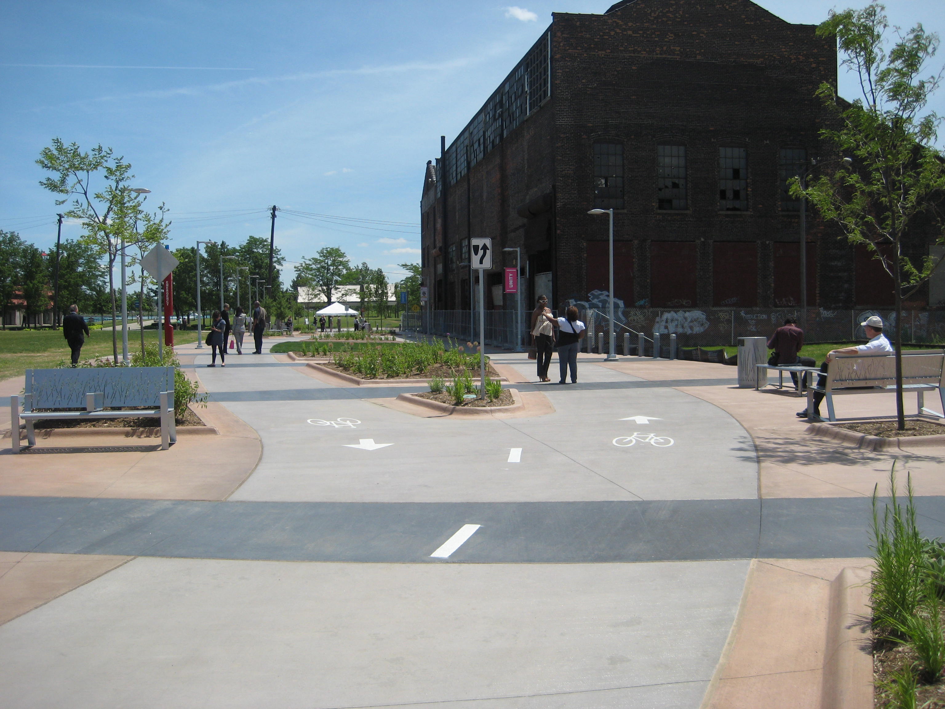
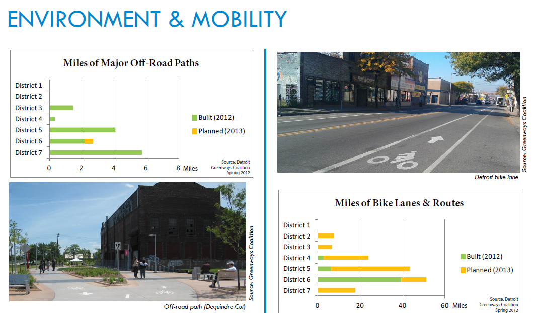
Off-road path (Dequindre Cut)
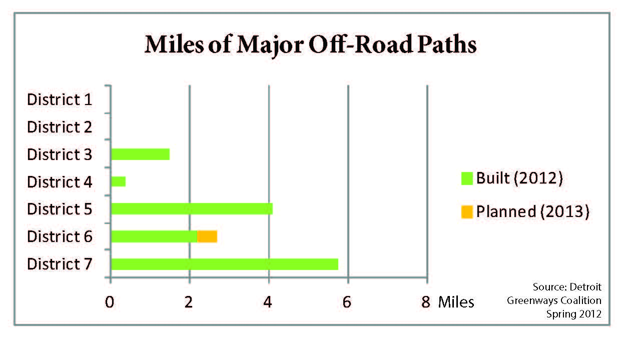
Source: Greenways Coalition
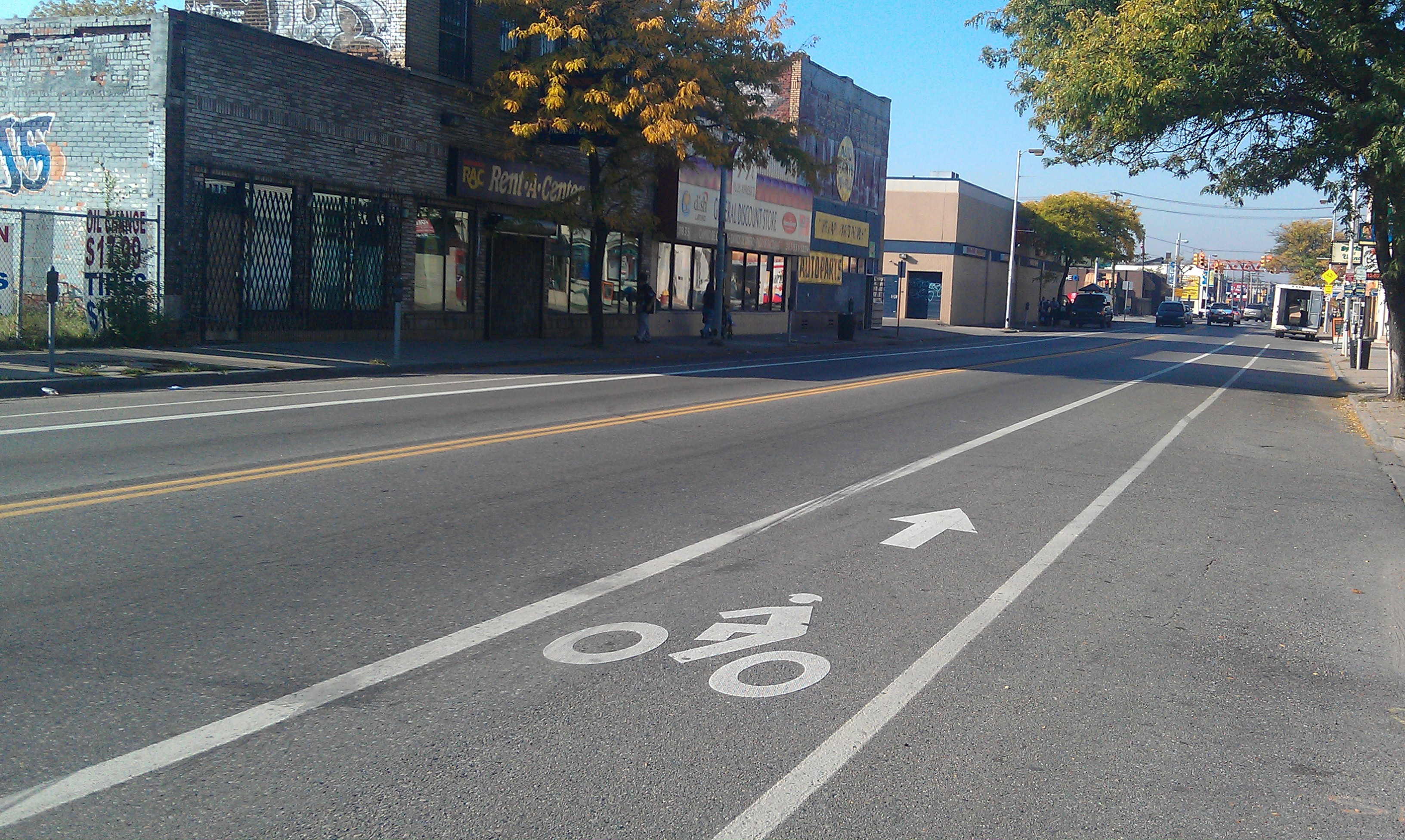
Detroit bike lane
Source: Greenways Coalition
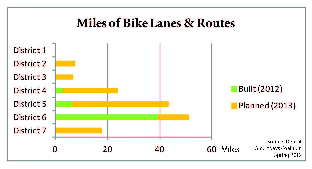
Non-motorized transportation expands healthy options
In a city where 33% of our low-income residents and 38% of our elderly residents don’t have access to a car and the local bus system is given a D grade, many residents walk, bike, and ride scooters on the roadways to get where they need to go. Even residents who have cars want to be able to walk or bike to amenities. Detroit’s Non-motorized Transportation Master Plan, adopted in 2006, is guiding the creation of biking and walking infrastructure and facilities in the city.
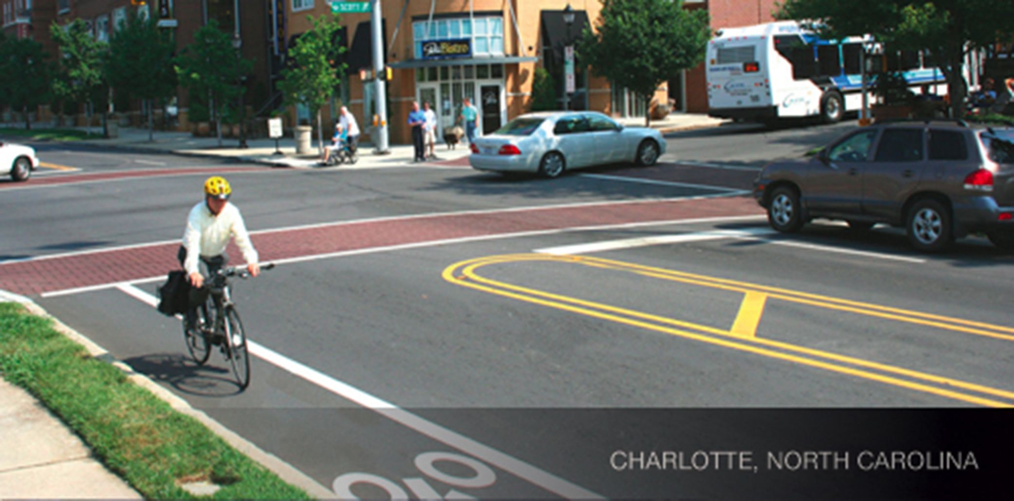
A Charlotte, N.C. complete street
Source: National Complete Streets Coalition
Complete Streets make roadways safe for all users, including pedestrians, cyclists, seniors on scooters, parents with strollers, and children – not just automobiles. The Detroit Complete Streets Coalition is advocating for a local complete streets policy, currently under review at the Law Department.
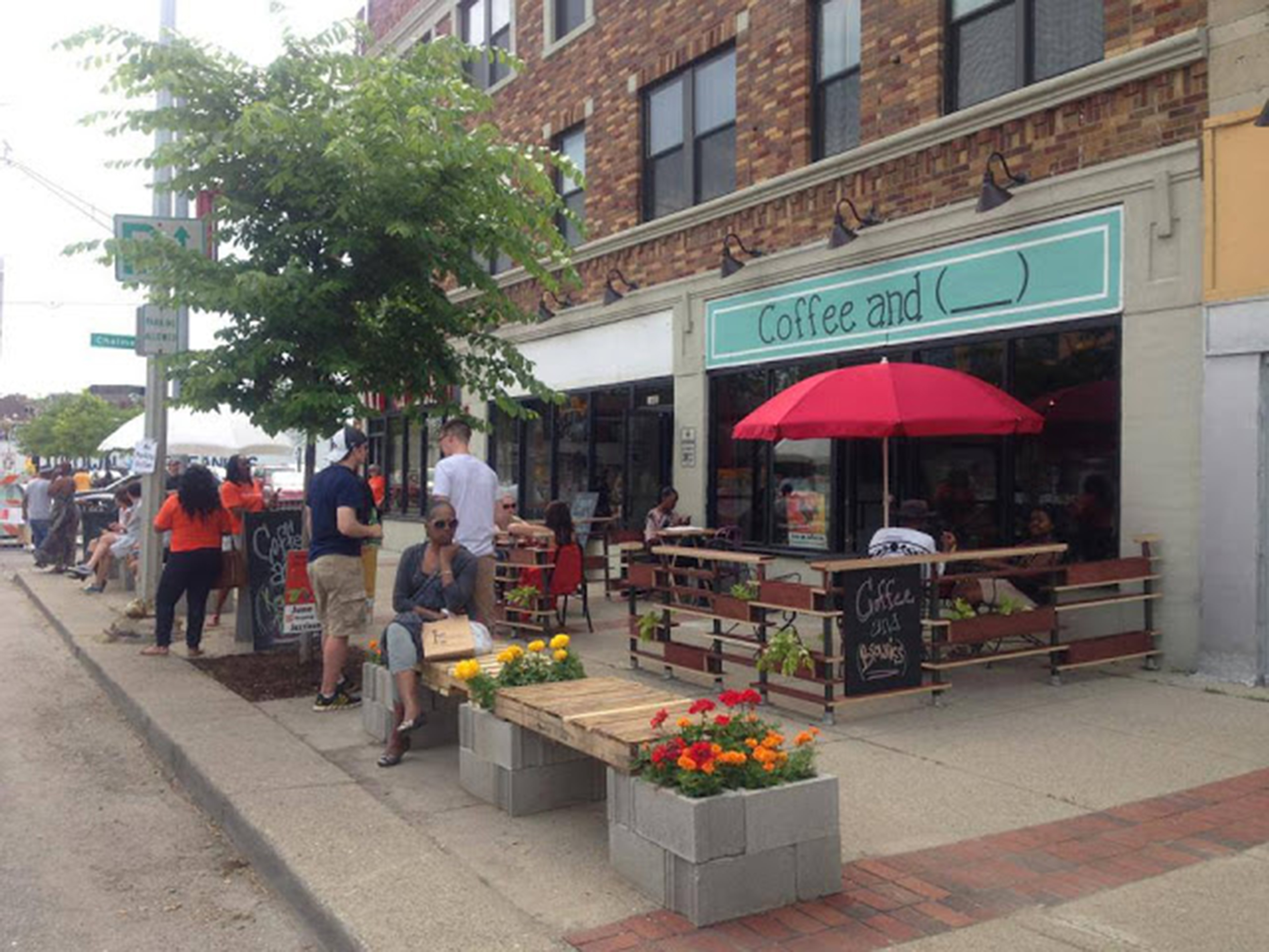
Jefferson East Business Association sponsored June of Jefferson, a summer collection of popup businesses (temporary restaurant and retail establishments) at Jefferson and Chalmers to demonstrate what a walkable, mixed-use community there could look like.
Photo: Nicole Rupersburg, Eat it Detroit
Walkable communities improve quality of life because a mix of goods and services are within an easy and safe walk from home. Pedestrian activity increases transportation options and makes communities safer through greater social interaction and more eyes on the street. The Clark Park neighborhood in Southwest Detroit is highly walkable, with parks, schools, grocery stores, homes, and shops all within close proximity. More of Detroit should have walkable communities.
In 2012, a joint workgroup of the City Planning Commission and the Planning Department updated the zoning code to create two mixed-use zoning designations. In addition to making communities more walkable, mixed-use areas can help support local business development.