Click here for the full Environment, Land & Water Infrastructure section
SEE FULL TEXT BELOW:
ENVIRONMENT, LAND & WATER INFRASTRUCTURE
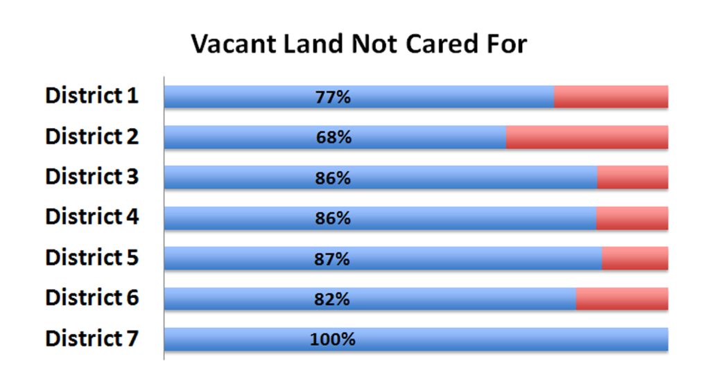
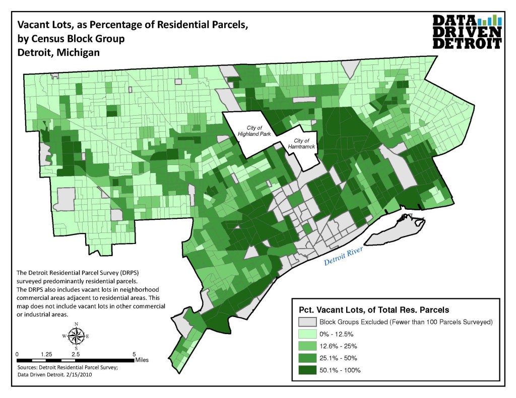
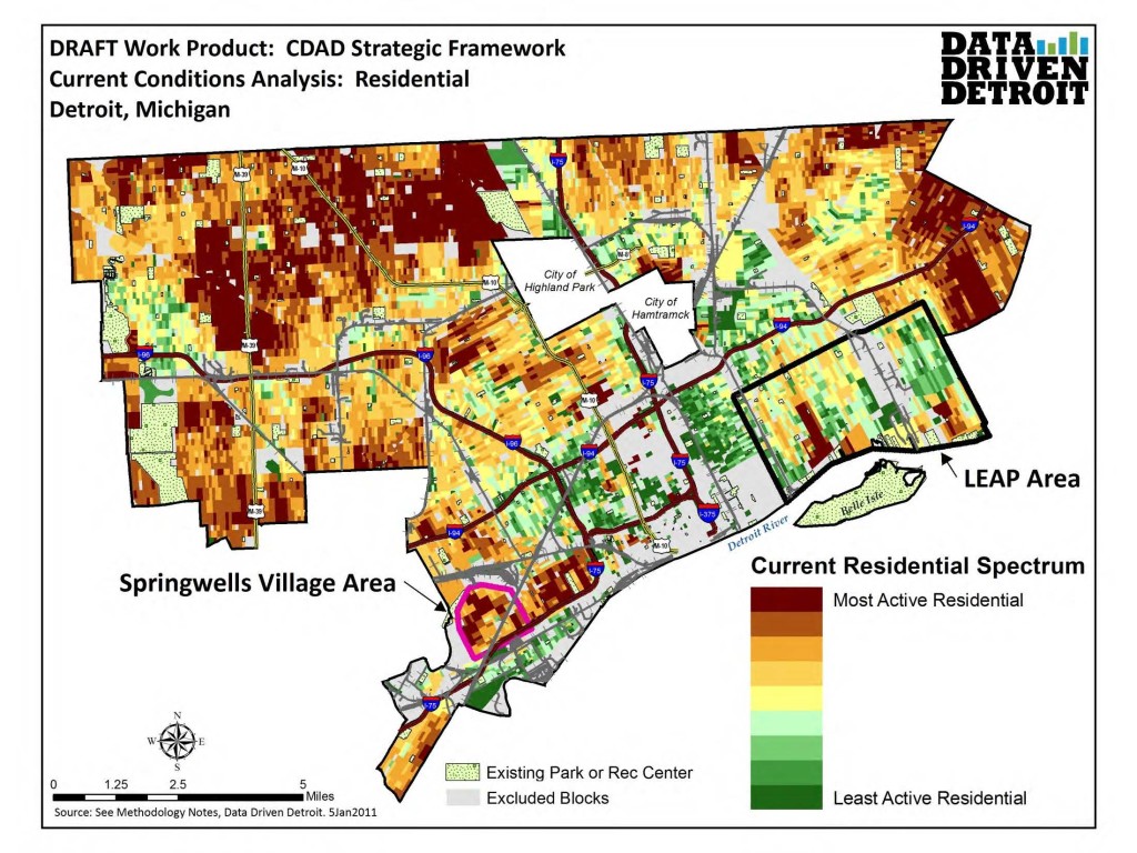
Vacant land refers to parcels with no structure present. All seven districts ranked “Vacant Land Not Cared For” in their top 10 problems. As can be seen in the green Data Driven Detroit map above, vacant residential lots are a significant issue in all of the city but most of District 2, the Grandmont Rosedale area, and the borders of the city near 8 mile west of Woodward, and the far eastside neighborhoods bordering the Pointes. District 2’s unexpectedly high ranking of this issue may be due to the high number of survey responses coming from the Davison area, which borders Districts 5 and 7, and the low total number of responses from District 2.
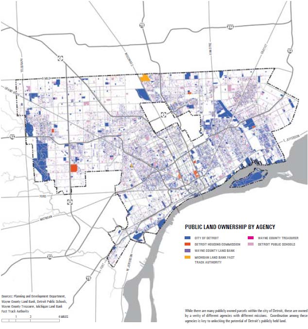
The Detroit Future City map of publicly owned land (below far left) indicates that a large portion of the land in the high vacancy areas are owned by public entities, most significantly the City of Detroit. Further analysis should be conducted to identify areas where high concentrations of vacant land with no structure are owned by the City of Detroit, the Wayne County Treasurer, and other public land holding agencies.
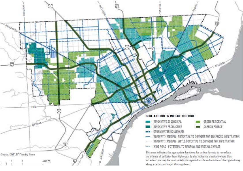
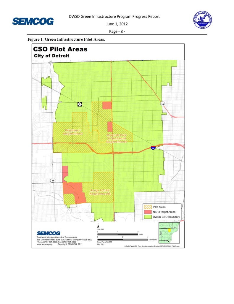
The map above to the left describes areas considered suitable for blue and green infrastructure by the Detroit Future City Strategic Framework Plan. The map above to the right indicates a spectrum of suitability for residential land use and alternative green land uses based on a variety of factors, including population density, population change, ownership, housing conditions, and more. The map to the immediate right demonstrates Combined Sewer Overflow pilot areas for the Detroit Water Sewerage Department.
In the abundance of vacant land lies opportunity for large-scale green infrastructure to significantly reduce combined sewage overflows to the rivers while addressing vacant land, a top priority of Detroit residents. This will require effective coordination with other public property owners, partnership with community land use visioning efforts, guided by the regional Green Infrastructure Vision led by SEMCOG, and suitability analyses conducted by various entities, including Detroit Future City, the Community Development Advocates of Detroit (CDAD) Strategic Framework Plan, and forthcoming research from Liquid Planning Detroit (University of Michigan).
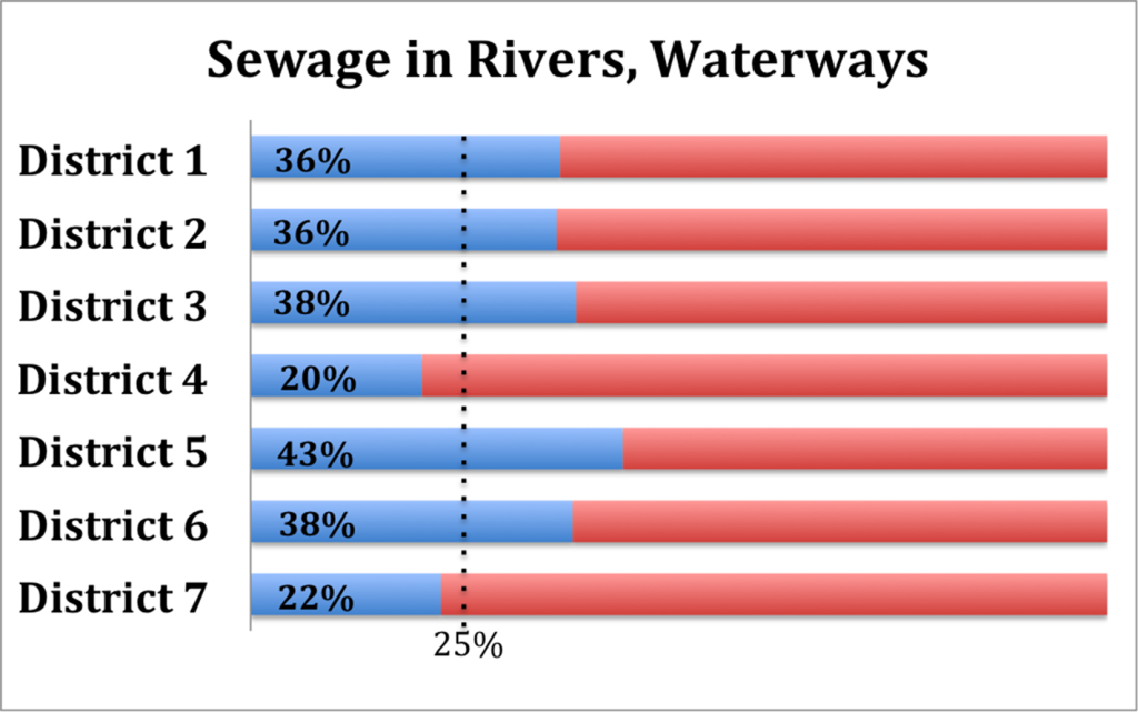
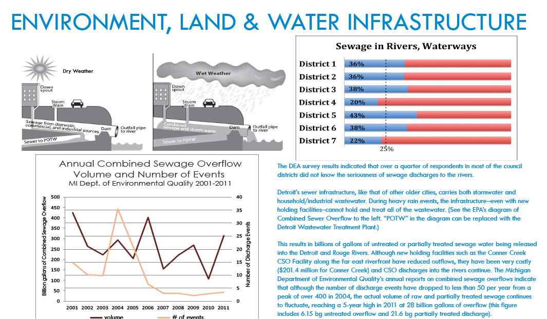
The DEA survey results indicated that over a quarter of respondents in most of the council districts did not know the seriousness of sewage discharges to the rivers.
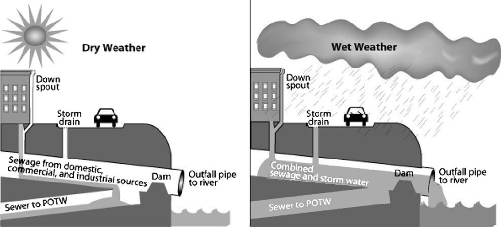
Detroit’s sewage infrastructure, like that of other older cities, carries both stormwater and household/industrial wastewater. During heavy rain events, the infrastructure – even with new holding facilities – cannot hold and treat all of the wastewater. (See the EPA’s diagram of Combined Sewer Overflow to the left. “POTW” in the diagram can be replaced with the Detroit Wastewater Treatment Plant.)
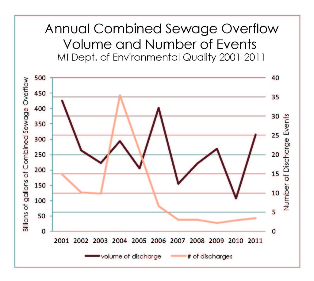
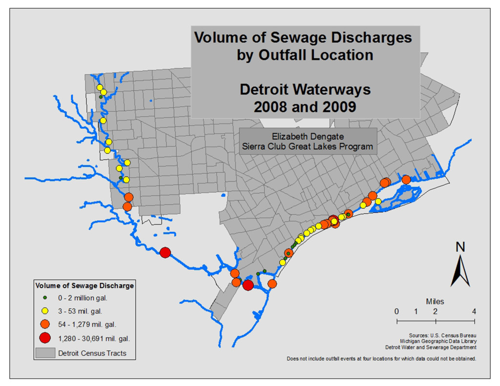
This results in billions of gallons of untreated or partially treated sewage water being released into the Detroit and Rouge Rivers. Although new holding facilities such as the Conner Creek CSO Facility along the far east riverfront have reduced outflows, they have been very costly ($201.4 million for Conner Creek) and CSO discharges into the rivers continue. The Michigan Department of Environmental Quality’s annual reports on combined sewage overflows indicate that although the number of discharge events have dropped to less than 50 per year from a peak of over 400 in 2004, the actual volume of raw and partially treated sewage continues to fluctuate, reaching a 5-year high in 2011 at 28 billion gallons of overflow (this figure includes 6.15 bg untreated overflow and 21.6 bg partially treated discharge).
Both the Detroit Water Agenda (published through the City Council Green Task Force in 2012) and the Detroit Future City Strategic Framework Plan emphasize the need for green infrastructure to alleviate the combined sewer overflow issue. With Detroit’s abundance of vacant land in need of cleanup and maintenance, this provides an opportunity to hit multiple birds with one stone. The Detroit Water and Sewerage Department, in partnership with the Southeast Michigan Council of Governments (SEMCOG) and The Greening of Detroit, is pursuing green infrastructure as an alternative to extremely costly conventional sewer infrastructure, beginning with pilot projects in Rouge Park and Brightmoor.
SEMCOG is developing a regional green infrastructure vision with other Detroit shareholders. Given the impact of regional wastewater on Detroit’s sewer infrastructure, elected leadership in Detroit should take an enthusiastic role in the process. Several other large cities (notably New York and Chicago) have launched major green infrastructure initiatives to address their stormwater challenges through grant programs, water bill credits, zoning amendments, and development standards to encourage a variety of strategies, including green roofs, green alleys, rain gardens, permeable parking lots, and more.
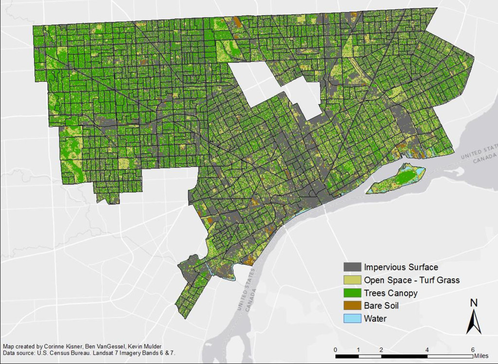
City Council District Percent Impervious
1 40.11%
2 47.35%
3 47.89%
4 46.60%
5 47.06%
6 50.97%
7 42.63%
Sources: Sanborn (2008); Data Driven Detroit 2012
*This calculation does not include roads, which would increase the numbers.
46.18%* of Detroit’s land is impervious, meaning that water cannot filter naturally into the ground.
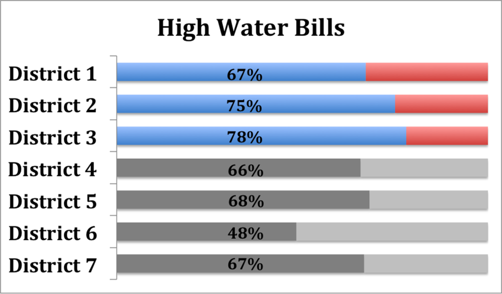
Survey respondents in 3 out of 7 districts (indicted in blue and red) ranked high water bills in their top 10 environmental problems. Water bills go to pay for Detroit Water and Sewerage Department (DWSD) infrastructure debt as well as operating the water and sewer systems. A 2012 DWSD brochure explains that declining water sales due to factory cutbacks, population decline, and increased water conservation and reduced water usage have resulted in higher rates.
The department acknowledges that it must change to respond to a future with less water consumption. The last Water Master Plan was published in 2003 and projected 2% annual growth for 50 years; “the reality has been 3% contraction for the last 4 years!” (DWSD “Putting Rate Increases into Perspective”)
The Detroit Emergency Manager’s June 2013 proposal for creditors suggests spinning off the water department into an independent New Metropolitan Area Water and Sewer Authority to be overseen by a regional board of directors. The system would be owned by the city and manged by the board.
Because the original plan to upgrade Detroit’s sewer infrastructure was too expensive, DWSD shifted its approach to include green infrastructure strategies to harness the environment for natural water filtration. Even so, green infrastructure investment only accounts for 6% of the overall combined sewer overflow budget.
Whatever authority ultimately manages the Detroit Water and Sewerage Department must find a way to encourage water conservation and on-site stormwater management. It must not rely on increased water consumption to pay infrastructure debt.
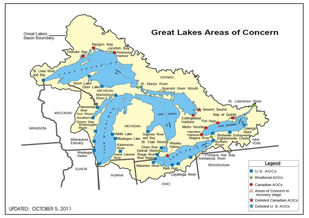
The Great Lakes account for 95% of U.S. surface freshwater, and over 20% of the world’s freshwater supply. Much of the coastlines are polluted from historic and current industry and combined sewage overflows. How will we steward our biggest natural asset?
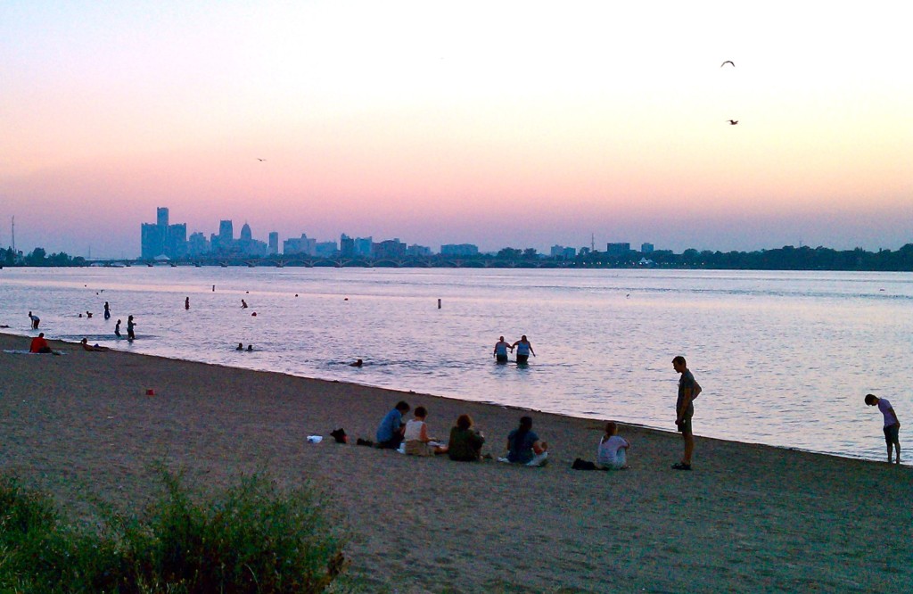
Belle Isle Beach
Photo: Sandra Yu
